Applications
Government and Defense
Versatile Performance
Precision Outcomes
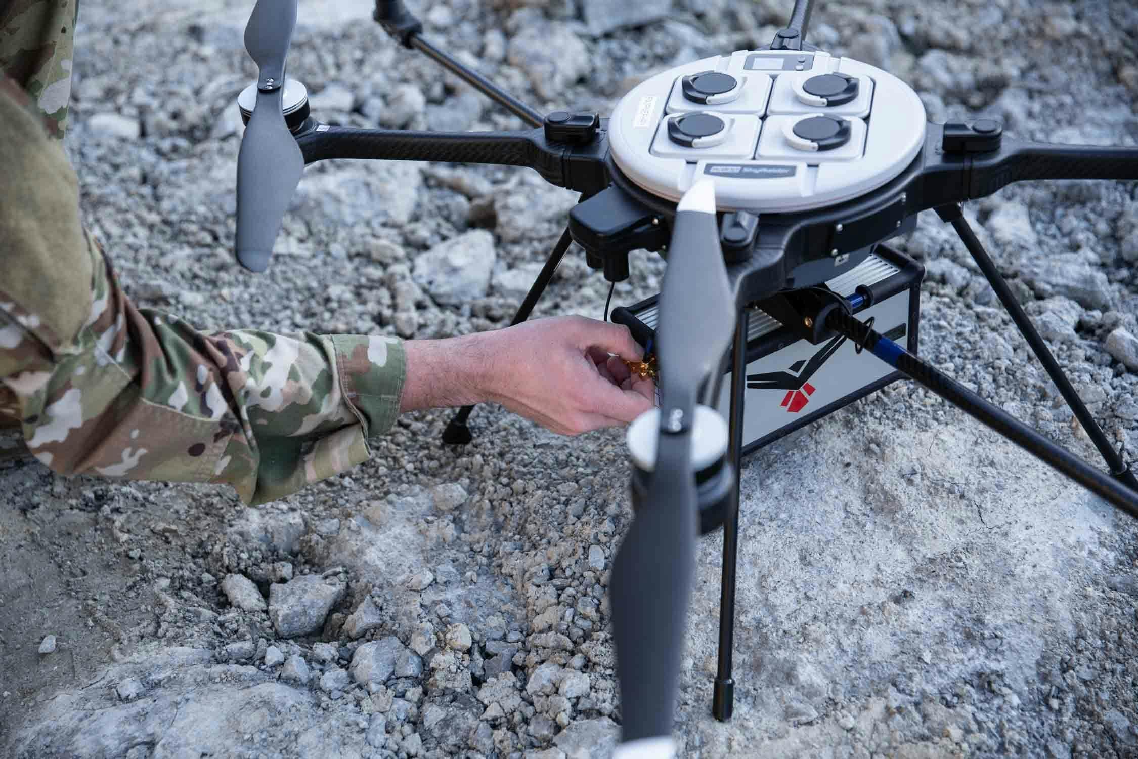
Ease of Use: The RedTail LiDAR RTL-450 workflow was developed specifically for Department of Defense and government customers. Guidance from military end-users was captured for the development of RTL-450’s easy-to-use and simple to understand interface. Operators are able to begin collecting high-quality 3D data with only a few hours of training.
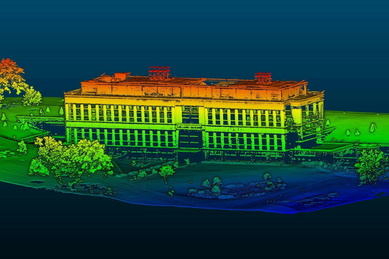
High-Resolution Point Clouds: The RedTail LiDAR System was developed by the Army Research Laboratory (ARL) to create high-resolution point clouds for military and government customers. The superior resolution of the point clouds generated by the RedTail LiDAR System allows customers to perform enhanced data analytics, including the incorporation of Artificial Intelligence/Machine Learning (AI/ML) algorithms for detection and classification.
FLIR SkyRaider and Blue UAS 2.0 Integration: The RTL-450 LiDAR system is a fully integrated payload on the Teledyne FLIR R80D SkyRaider – a DoD Program of Record sUAS – and both the FreeFly Alta X and the Inspired Flight IF1200 which are both certified as DoD Blue UAS 2.0 sUAS. As other sUAS are approved by the Defense Innovation Unit (DIU), RedTail LiDAR will provide a fully integrated LiDAR payload on those platforms.
DoD and Government Use: The RTL-450 is the system of choice for military and government customers. The underlying microelectromechanical systems (MEMS) mirror technology used in the RTL-450 was designed and developed by the Army Research Laboratory, Adelphi, MD. Systems have been operationally deployed within DoD as a 3D tactical imaging system
NDAA 848 Compliant
Safety Reviewed by U.S. Army Test and Evaluation Command
Laser Safety Approval by U.S. Army Public Health Center
Key Specifications: The RTL-450 LiDAR sensor by RedTail LiDAR Systems provides superior performance for sUAS applications, including:
- An operating altitude of 120 meters to provide superior area coverage on a given sUAS flight
- A low system weight of 4.8 pounds, facilitating integration on a broad range of sUAS platforms
- A high point density that allows sUAS platforms to fly at their maximum speed while still generating a point density that is 5 times greater than competing LiDAR products
- Low detectability: the 1550 nm laser frequency is not detectable by the human eye, making the RTL-450 the ideal LiDAR system for covert imaging applications
- Designed and assembled in the U.S.
Government and Defense Scenarios
Facilities Inspections
Learn More →
Battle Damage Assessment
Learn More →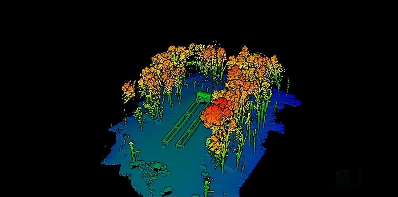
Mission Planning
Learn More →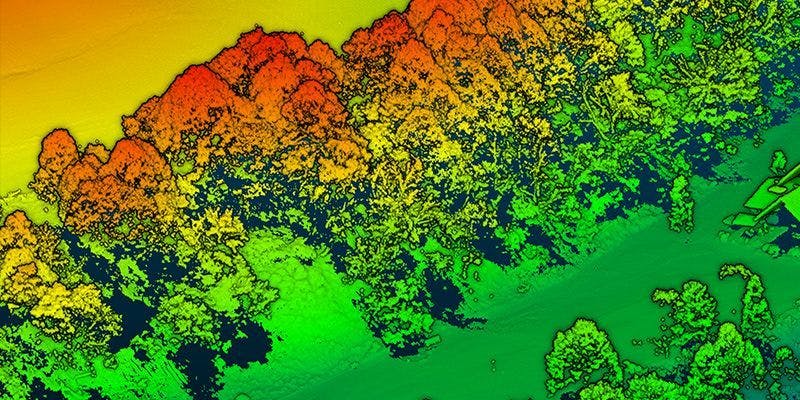
Under Canopy Imaging
Learn More →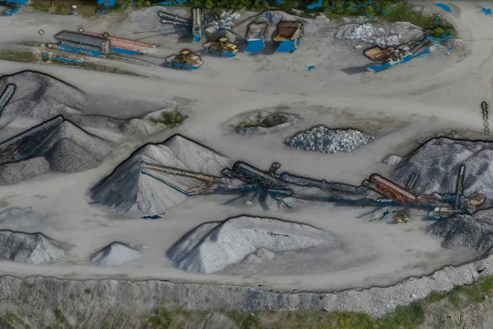
Construction
Learn More →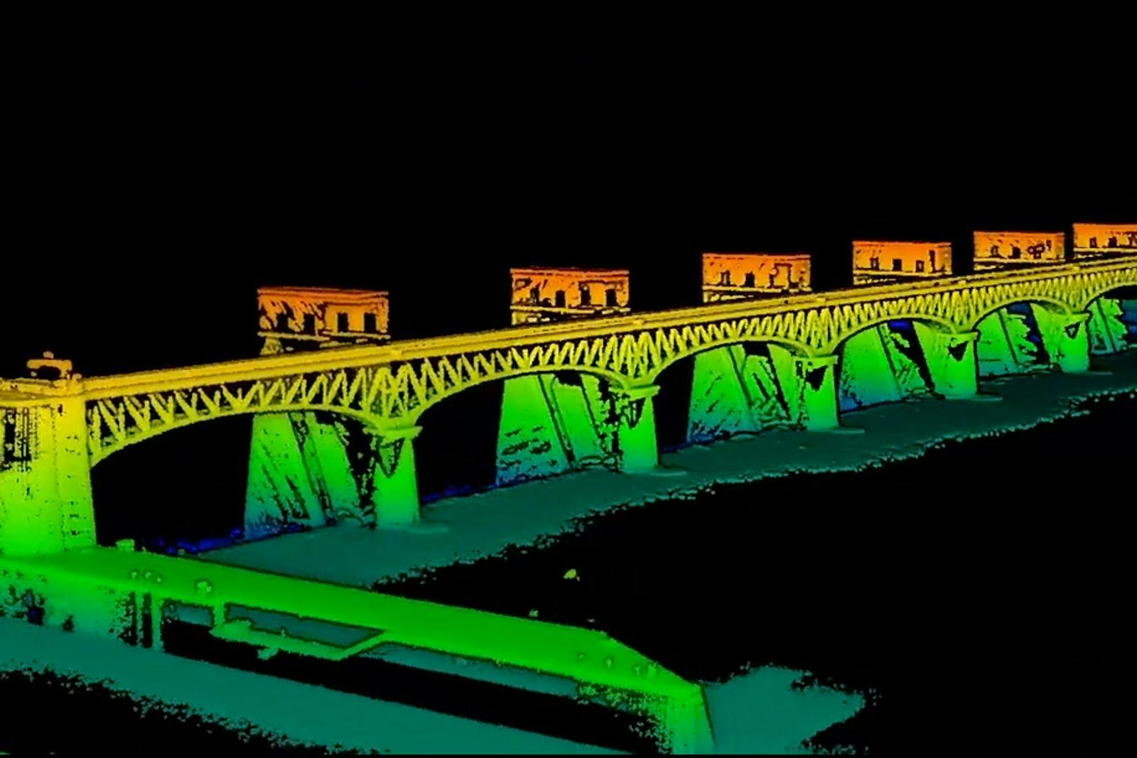
Critical Infrastructure Protection
Learn More →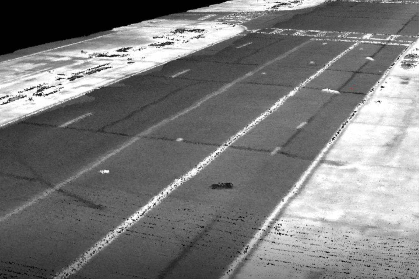
Unexploded Ordnance and Mine Detection
Learn More →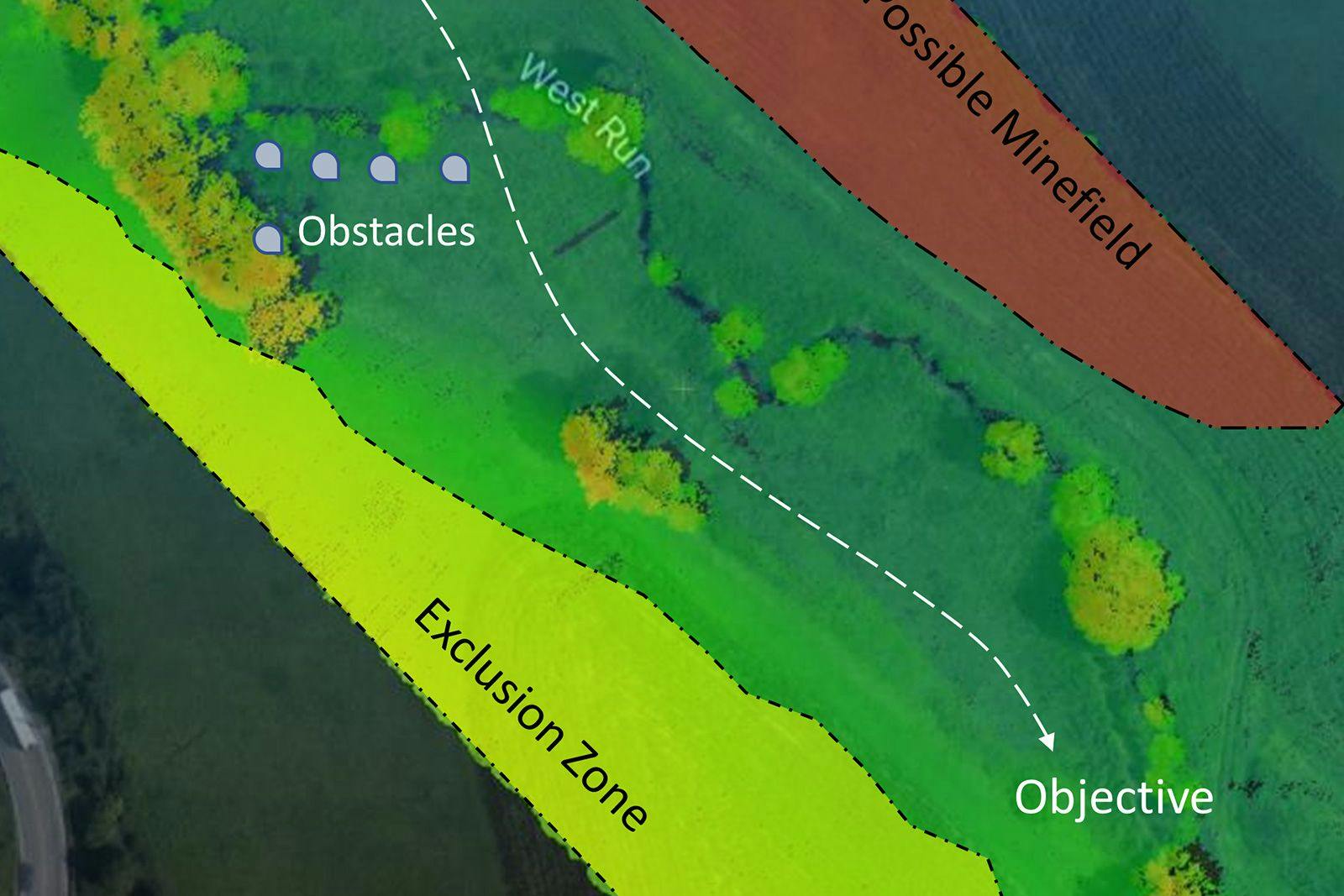
Route Planning
Learn More →Customers


Commercial Applications
Learn MoreSee how the RTL-450 will optimize sUAS LiDAR mapping for your organization.
Contact Us
RedTail LiDAR technology licensed from the U.S. Army Research Laboratory; U.S. Patent Number 10,444,330 B2. Scanning - the way it was meant to be is a trademarked slogan of RedTail LiDAR Systems. Specifications are subject to change.