Government and Defense Scenarios
Route Planning
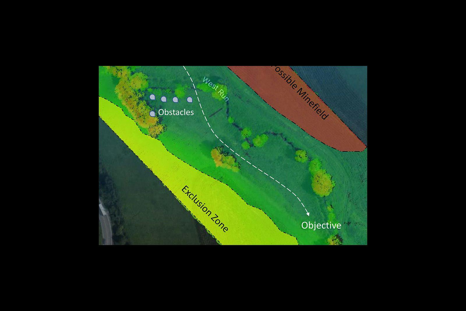
Accurate Route Planning on the battlefield is a key capability for combat planners. The ability to avoid known hazard areas can present a multitude of challenges while traversing dangerous and remote areas, as well as navigating complex urban centers. These vitally important corridors can be difficult to survey, map, analyze, and monitor, putting critical assets at risk. 3D point clouds can be used for mounted and dismounted operations route planning and can be used to optimize the traverse of unmanned ground vehicles (UGVs) to avoid obstacles and rough terrain.
Designed specifically for small unmanned aerial vehicles, the RedTail LiDAR System combines the agility and operability of a UAV with a superior point cloud generation tool. Together, they create high-resolution, highly accurate, 3D maps of operational environments quickly and without endangering personnel.
Data collected from corridor flights can be used to 1) create topographic maps and boundary surveys prior to deploying personnel and equipment. 2) collect accurate position information of wires, structures, vegetation, and terrain, 3) monitor the safety clearance area around power and pipelines, 4) monitor environmental conditions including fault and landslide hazard detection, wetlands, and river crossings, assess and monitor road surface damage, and compute cross section parameters and road alignment.
The RedTail LiDAR System is the optimal tool to provide high-resolution 3D point clouds for route planning. With a pulse repetition rate of up to 400,000 pulses per second, even ground-point distribution, superior ranging capability, and optimized scan angles, the RedTail LiDAR System will exceed your route mapping needs.
See how the RTL-450 will optimize sUAS LiDAR mapping for your organization.
Contact Us
RedTail LiDAR technology licensed from the U.S. Army Research Laboratory; U.S. Patent Number 10,444,330 B2. Scanning - the way it was meant to be is a trademarked slogan of RedTail LiDAR Systems. Specifications are subject to change.