News

news
2025-05-21
RedTail LiDAR Exhibits at SOF Week 2025 and XPONENTIAL 2025
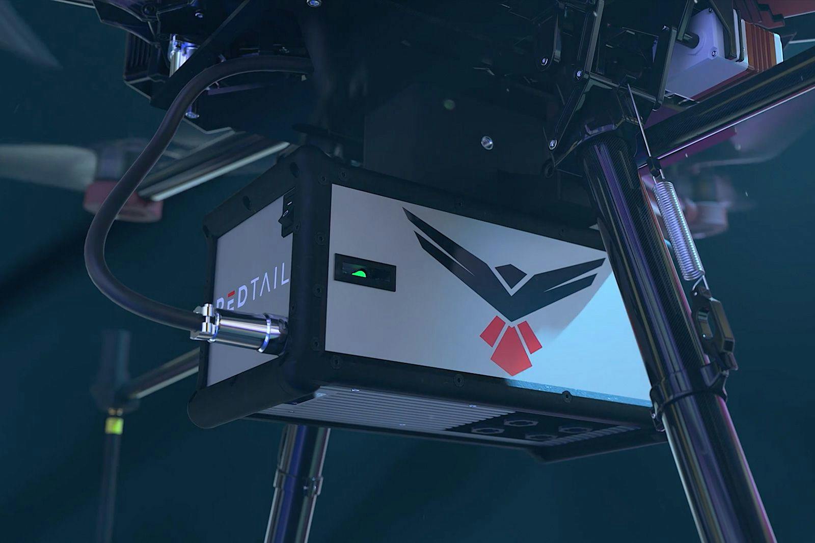
RedTail exhibited its MEMS mirror-based LiDAR products at both SOF Week 2025 (Tampa, FL) and XPONENTIAL 2025 (Houston, TX). Now a part of Accenture Federal Services, RedTail is rapidly introducing LiDAR analytic services just as its second major product release approaches a late ...
Read full article →
news
2024-10-07
RTL-450 Joins Blue UAS Framework
We are excited to announce that the RedTail RTL-450 is now officially part of the Blue UAS Framework! This significant milestone highlights the importance of our RTL-450 LiDAR technology in meeting the highest standards for security. By joining this exclusive framework, the RTL-4...
Read full article →
events
2024-04-22
RedTail LiDAR Systems to Bring Cutting-edge 3D Sensing Technology to XPONENTIAL 2024
The San Diego Convention Center will play host to XPONENTIAL 2024, a premier gathering of leaders in unmanned systems, robotics, and autonomous technology, from April 22-25. Industry professionals will have the opportunity to explore the latest innovations, and RedTail LiDAR Syst...
Read full article →
events
2024-04-21
RedTail to Exhibit at SOF Week 2024
We are excited to participate in #SOFWeek2024, the most anticipated networking & collaboration event of the year for the special operations community. Come learn how our LiDAR solution is changing outcomes one mission at a time, pulse by pulse, insight by insight. With industry...
Read full article →
news
2024-04-18
Dr. Stephen Pledgie joins RedTail as Vice President
In a significant corporate move, Dr. Stephen Pledgie has been appointed as the new Vice President of RedTail Lidar Systems, a role that promises to harness his technical expertise and strategic insights in imaging systems and the computer vision industry. Mark Evans, Director of ...
Read full article →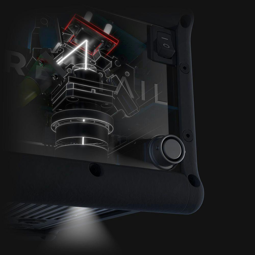
industry
2022-07-09
Optimal LiDAR Data Resolution Analysis for Object Classification
Citation: Darrah, M.; Richardson, M.; DeRoos, B.; Wathen, M. Optimal LiDAR Data Resolution Analysis for Object Classification. Sensors 2022, 22, 5152. https://doi.org/10.3390/ s22145152
Abstract: When classifying objects in 3D LiDAR data, it is important to use efficient collection methods and processing algorithms. This paper considers the resolution needed to classify 3D objects accurately and discusses how this resolution is accomplished for the RedTail RTL-4...
Read full article ↗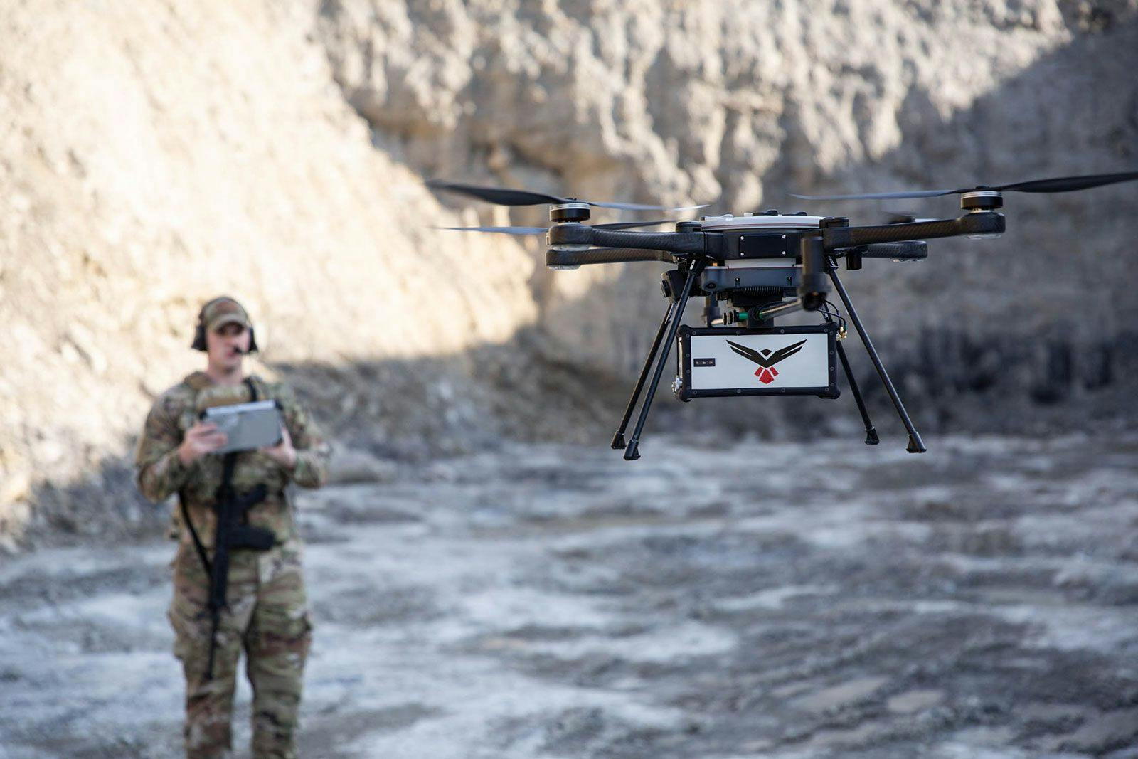
news
2021-12-08
RedTail LiDAR Systems Unveils Innovative LiDAR System for Small Drones
Cision Pr Newswire
The RTL-450 incorporates a lightweight MEMS mirror and a precision navigation system to generate accurate data for the most demanding of aerial surveying missions. The high-resolution, three-dimensional point clouds created by the RTL-450 provide operators an unsurpassed ability ...
Read full article ↗
news
2021-10-07
RedTail Delivers LiDAR System to DoD’s Explosive Ordnance Disposal Community
Fairmont, WV, October 4, 2021 — RedTail LiDAR Systems, a leader in microelectromechanical systems (MEMS) mirror-based light detection and ranging (LiDAR) technology, has delivered six LiDAR systems to the 707th Ordnance Company stationed at Joint Base Lewis-McChord. These systems...
Read full article →RedTail LiDAR technology licensed from the U.S. Army Research Laboratory; U.S. Patent Number 10,444,330 B2. Scanning - the way it was meant to be is a trademarked slogan of RedTail LiDAR Systems. Specifications are subject to change.