Government and Defense Scenarios
Unexploded Ordnance and Mine Detection
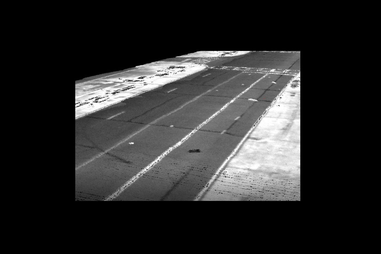
Unexploded Ordnance (UXO) and Mine Detection are critical battlefield functions that provide Operational Commanders the ability to quickly identify hazards and develop mitigation and neutralization plans to regain freedom of maneuver. LiDAR provides an excellent means of rapidly geolocating and characterizing UXO and mines to provide combat planners with key data to regain an effective operational posture. LiDAR allows remote assessment without putting personnel in harm's way and allows efficient collection of data on large areas.
Designed specifically for small unmanned aerial vehicles, the RedTail LiDAR System combines the agility and operability of a UAV with a superior point cloud generation tool. Together, they create high-resolution, highly accurate, 3D maps of areas of interest quickly and without putting personnel in harm’s way.
The RedTail LiDAR system is ideally suited for locating and identifying hazardous kinetic devices that pose risks to personnel and equipment. damaged runways to include computing volumetrics for compromised surfaces to support the determination of fill requirements, establishing the location of unexploded ordnance, and characterizing objects of interest on the ground. The system can also be used to baseline large-scale infrastructure pre-event to allow post-event comparisons to determine changes in structural integrity.
The RedTail LiDAR System is the optimal tool to quickly and effectively complete large-scale data collection to perform Battle Damage Assessment. With a pulse repetition rate of up to 400,000 pulses per second, even ground-point distribution, superior ranging capability, and optimized scan angles, the RedTail LiDAR System will provide precise, actionable data.
See how the RTL-450 will optimize sUAS LiDAR mapping for your organization.
Contact Us
RedTail LiDAR technology licensed from the U.S. Army Research Laboratory; U.S. Patent Number 10,444,330 B2. Scanning - the way it was meant to be is a trademarked slogan of RedTail LiDAR Systems. Specifications are subject to change.