Government and Defense Scenarios
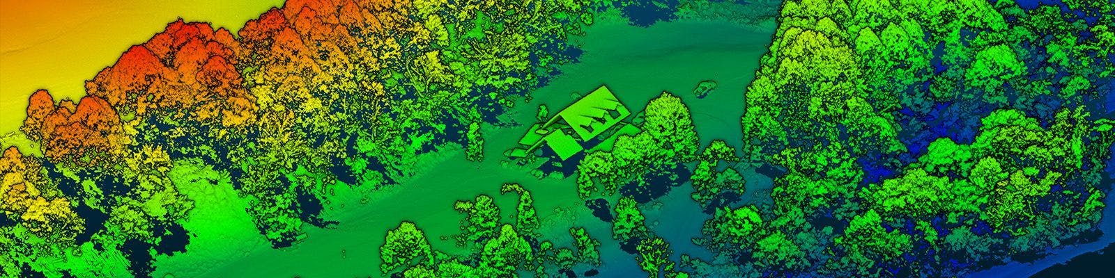
Under Canopy Imaging
RedTail LiDAR Systems’ RTL-450 is the perfect tool for developing high-resolution 3D point clouds in vegetated areas, allowing users to accurately map terrain beneath the canopy, create digital elevation models (DEMs), detect vehicles and objects hidden beneath vegetation, and perform intelligence, surveillance, and reconnaissance activities in hard-to-access or fortified operational areas.
The ability to visualize beneath the tree canopy is a significant benefit LiDAR can provide over RGB sensors. While RGB sensors can capture what is visible on the canopy surface, the RTL-450 LiDAR can transmit light through small openings in the canopy, to image objects below. Pulse repetition rate, beam divergence, scan angle, and the number of returns from each transmitted pulse all factor into the ability of a LiDAR system to penetrate the canopy. These factors have been optimized in a small, lightweight, low-power LiDAR imaging system that can be flown on small UAVs.
The RedTail LiDAR System is the optimal solution for canopy penetration. The small beam diameter of the RedTail LiDAR laser pulse, when combined with a low beam divergence and high pulse repetition rate, rapid side-to-side scan rate, and the ability to analyze multiple returns for every pulse transmitted, provides cutting-edge ability to detect and analyze objects beneath the canopy.
See how the RTL-450 will optimize sUAS LiDAR mapping for your organization.
Contact Us
RedTail LiDAR technology licensed from the U.S. Army Research Laboratory; U.S. Patent Number 10,444,330 B2. Scanning - the way it was meant to be is a trademarked slogan of RedTail LiDAR Systems. Specifications are subject to change.