Commercial Scenarios
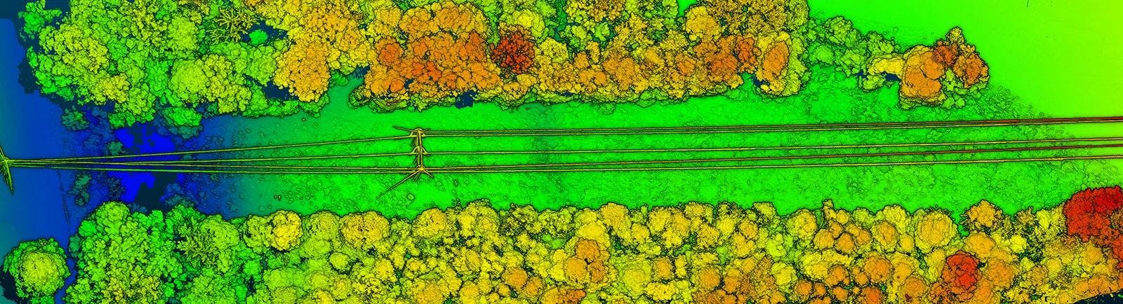
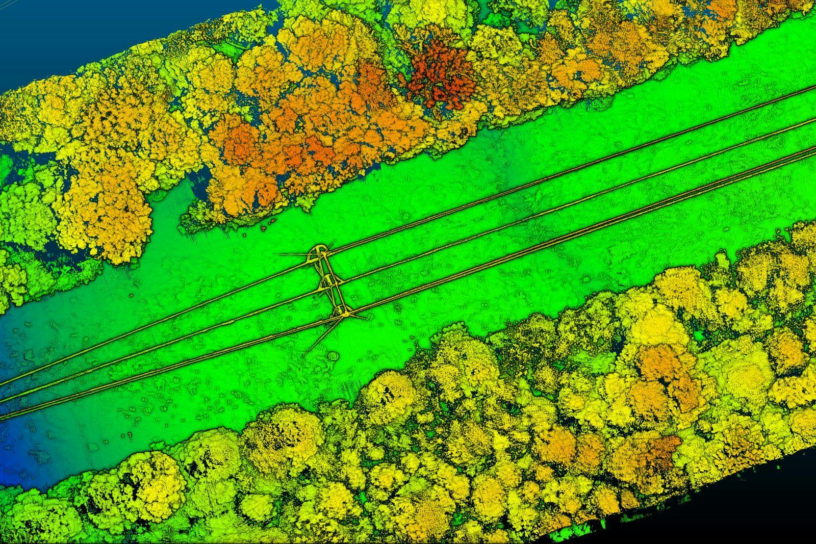
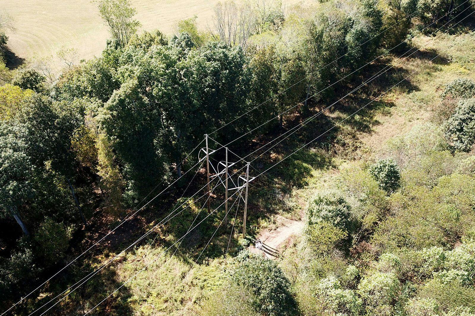
Corridor Mapping
When it comes to corridor mapping and planning, RedTail's UAV LiDAR system creates high-resolution, highly accurate, 3D maps of power lines, pipelines, highways, and railway corridor projects, quickly and without endangering people.
Building and maintaining safe and reliable energy and transportation corridors can present a multitude of challenges. Traversing dangerous and remote areas, as well as navigating complex urban centers, these vitally important corridors can be difficult to survey, map, analyze and monitor, putting these critical assets at risk.
Designed specifically for small unmanned aerial vehicles, the RedTail LiDAR System combines the agility and operability of a drone with a superior point cloud generation tool.
Data collected from corridor flights can be used to 1) create topographic maps and boundary surveys prior to construction, 2) inspect and monitor conditions of existing infrastructure, 3) collect accurate position information of wires, structures, vegetation, and terrain, 4) improve maintenance planning and scheduling for crews and equipment, 5) monitor the safety clearance area around power and pipelines, 6) monitor environmental conditions including fault and landslide hazard detection, wetlands, and river crossings, and 7 ) assess and monitor road surface damage, and compute cross-section parameters and road alignment.
The RedTail LiDAR System is the optimal tool to help you plan, build, and monitor your next corridor project. With a pulse repetition rate of up to 400,000 pulses per second, even ground-point distribution, superior ranging capability, and optimized scan angles, the RedTail LiDAR System will exceed your energy and transportation corridor needs.
See how the RTL-450 will optimize sUAS LiDAR mapping for your business.
Contact Us
RedTail LiDAR technology licensed from the U.S. Army Research Laboratory; U.S. Patent Number 10,444,330 B2. Scanning - the way it was meant to be is a trademarked slogan of RedTail LiDAR Systems. Specifications are subject to change.